Check out ‘open use’ terrain editor TerreSculptor 2.0
Generate height maps for games and animations with this promising free application.
Demenzun Media – aka developer David Green – has released TerreSculptor 2.0, a new ‘open use’ version of his terrain generation and editing software. That makes it available free, rather than open source, but it’s an interesting tool, and one that provides an alternative to commercial applications like Gaea, World Machine or Instant Terra for generating terrain for games and real-time applications.
Previously a commercial tool
TerreSculptor has been around for a while – the first public alpha came out in 2012 – but until version 2.0, the only open use version was the Standard Edition: the advanced features were in the Professional Edition, which was a commercial product.
David Green has now switched to a Patreon-funded ‘pay if you like it’ model, and made the software available as a single full-featured edition, free for personal, academic and commercial use.
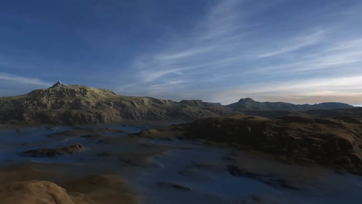
The software generates terrains for use in games and real-time applications, either by editing real-world elevation data, or creating terrain from scratch, exporting the result as a heightmap or a 3D mesh.
Use simple ‘Photoshop-like’ filters to modify terrain
TerreSculptor can generate terrains based on a range of procedural noise types, including Perlin noise. There are presets for a range of common landscape types, like mountain ranges, lakes and rivers, and you can adjust the results via simple slider controls, viewing the result as a 3D preview.
It is also possible to import height maps generated in other software at up to 64-bit resolution, or to import real-world elevation data in a range of common formats, including DEM, GeoTIFF and HGT.
Once inside TerreSculptor, terrains can be modified via a range of “Photoshop-like” filters, including both general operations like flip, rotate, blur and invert, and landscape-specific processes, including four erosion types – hydraulic, rain, slope and thermal – and the option to set the water level for the terrain.
Export heightmaps at up to 65K resolution
Providing your workstation has enough memory, you can export heightmaps at resolutions of up 65,536 × 65,536, with the option to divide large maps into tiles. The software supports over 100 file formats, including 64-bit TIFFs and PNGs, and can also generate accompanying weight maps from the terrain – options include slope angle, altitude and by flowline – for use as masks in other software.
It is also possible to export 3D terrains as OBJ or 3DS files, or in Terragen’s native TER format.
The online documentation for version 2.0 is still a work in progress, so you may have to work out what some of the parameters do for yourself, but you can still download version 1.0, which includes a PDF manual, and it isn’t too hard to work out where commands have moved to in the interface.
System requirements
TerreSculptor 2.0 is available for Windows 7+ only, and is free to use for both personal and commercial projects. If you like the software, you can support its development on Patreon.