
Visualizing Geospatial data with BlenderGIS and Blend4Web
Blend4Web Team writes:
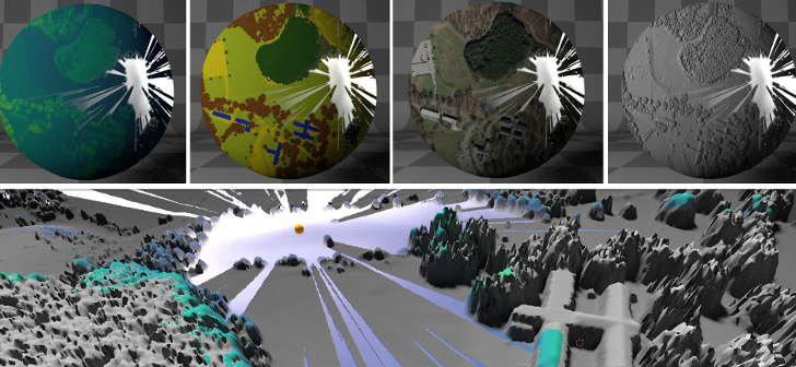
We’d like to share the information about an awesome scientific project carried out at the North Carolina State University, with the community.
“What if your geospatial data and simulations like flooding, fire-spread and viewshed computations are converted on-the-fly into realistic, interactive and immersive 3D worlds, without the need to deal with overly complicated or proprietary 3D modeling software? In this hands-on workshop we will explore how to automate importing and processing of various types of geospatial data (e.g., rasters, vectors) using Blender, an open-source 3D modeling and game engine software.”


I went thru your tutorial line by line using Blender 2.78 but could not get it to work. All goes well until I try to insert the Example1_DSM.Tif. Blender gives an error of “unsupported format.” I am excited by your tutorial and work, but can you look at your procedure again to see if a step is missing? This method could be used to great effect in ArchViz work. Nice job on all the Python programming.
Hey Bob,
You might want to contact with the developer directly https://github.com/ptabriz