
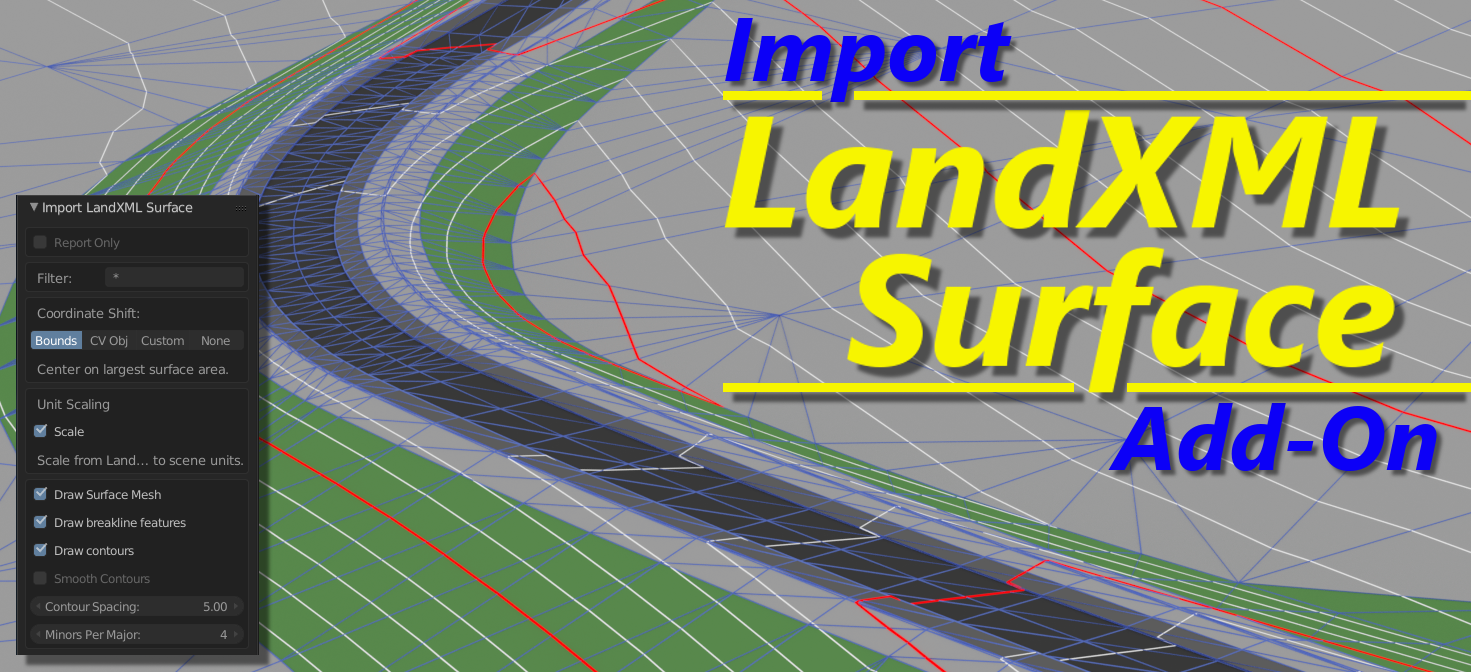
Import LandXML Surface Add-On
Civil Visions writes:
The first in our series of civil engineering add-ons for Blender, the LandXML Surface Import add-on makes it quick and easy to import existing and proposed LandXML surface models for project visualization. Import supports triangulated surfaces and breakline features with generated user-defined major and minor contours.
The add-on is available now from Blender Market.

Hi)
A very nice move – it is always awesome to have more compartibility with other formats!
But, as it is different from mesh format, there need to be some explanations in a couple of words about what software produces this format, and application area of this software.
Quoting from the first paragraph on the Bender Market page:
“Whether you’re creating visualizations for architecture, civil site designs, or transportation projects, LandXML is the fastest and easiest way to bring terrain into Blender. Easily exported by virtually all civil design applications, LandXML is the perfect link between CAD design and visualization in Blender.”
LandXML is an open format for civil and transportation engineering. Most people in the architectural or civil engineering industry will be familiar with LandXML as a transfer format between their software applications.
Thank you for an answer)
For sure, but the problem is that I’m that guy from architectural or civil engineering imdustry, that wrote OBJ autocad exporter on lisp, and is familiar to different industry standard formats, such as DWG/DXF, FBX, ACIS SAT, IFC (donator of IFCOpenshell), XML, MAX, RVT, XML/SVG SKP and even OSM, but there is first time I hear about LandXML.
I already bougt converter, so, I’m wandering, can you tell me what software is able to produce such file format?
Thanks for update, but can you tell how this file format can be obtained?
It seems, it refers to Civil 3D, but it is not clear what data type it handles – only project object or even lidar scans